

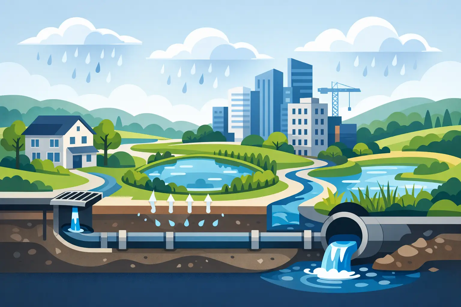
A drainage strategy for new development is often treated as a planning document to be completed once layout, levels and access have already been fixed. That approach creates avoidable redesign, delayed discharge approvals and expensive drainage diversions. For housing, commercial, industrial and infrastructure schemes, drainage must instead inform the developable area, finished floor levels, road geometry, utilities corridors and construction sequence from the earliest feasibility stage.
The objective is not simply to remove water from a site. A compliant strategy must demonstrate that surface water and foul flows can be managed safely, without increasing flood risk on or off site, overwhelming receiving networks or leaving an unmaintainable drainage asset for the operator, management company or landowner.
What a drainage strategy for new development must establish
A drainage strategy is a coordinated technical basis for planning, detailed design and approvals. Its scope will vary by site and local planning authority, but it should establish the existing drainage regime, likely discharge routes, drainage constraints, proposed SuDS measures, flood-routing arrangements and the party responsible for long-term operation.
For most schemes, the first question is whether surface water can infiltrate to ground safely and reliably. The answer cannot be assumed from a desktop geology review or from a single trial pit. Infiltration testing should be undertaken at representative locations and depths, normally in accordance with BRE 365, with groundwater levels, seasonal variation, soil contamination and slope stability considered alongside the test results. On former industrial land, infiltration may be unsuitable where it could mobilise contaminants or create a pathway to controlled waters.
Where infiltration is not feasible, the strategy should consider discharge to a watercourse, surface water sewer or, only where justified, a combined sewer. The drainage hierarchy applied by the relevant lead local flood authority (LLFA), planning authority and sewerage undertaker will determine the evidence required. A proposed connection does not demonstrate that capacity is available. Early engagement and written technical responses are necessary before a layout is allowed to depend on a receiving asset.
Foul drainage requires equal care. The proposed point of connection, downstream capacity, pumping requirement, easements and diversion implications should be identified before planning conditions become critical-path items. A gravity connection may be preferable operationally, but levels, existing utilities and off-site rights can make it impractical. If pumping is required, designers must address resilience, access, alarms, emergency storage and the maintenance regime rather than treating the pumping station as a late civils detail.
Start with evidence, not standard details
A defensible drainage strategy begins with site-specific data. Topographical survey information must extend beyond the development boundary where overland flows, ditches, culverts or outfalls may influence the design. Existing drainage records are useful, but they are not confirmation of alignment, condition or ownership. CCTV surveys, manhole inspections, utility searches and targeted investigation may be required to establish what is actually present.
The flood risk assessment and drainage strategy should be developed together. Flood zones alone do not describe all relevant risk. Surface water mapping, ordinary watercourses, reservoir inundation, groundwater emergence, culverted assets and interaction with third-party land can all affect site layout and safe access. Finished floor levels must account for the agreed flood-risk approach, while site levels should retain practical overland exceedance routes away from buildings and critical infrastructure.
Climate change allowances need to be applied to the correct design storm and agreed with the relevant authority. The precise allowance depends on the development type, vulnerability and local policy. Applying a generic figure without recording the basis of the decision can lead to challenge during planning or detailed technical approval.
Designing SuDS as working infrastructure
Sustainable drainage systems should deliver water quantity, water quality, biodiversity and amenity benefits where site conditions allow. The strongest schemes use a management train: source control close to roofs and hardstanding, conveyance features that slow and treat runoff, then site control and final discharge measures. This is more effective than directing the entire site to a single underground attenuation tank.
Permeable paving, rain gardens, swales, filter strips, detention basins, ponds and wetlands can each be appropriate, but none is automatically suitable. Permeable paving requires a clear maintenance plan and consideration of sub-base contamination risk. Swales need land take, suitable gradients and protection from compaction during construction. Open basins can provide valuable storage and visual amenity, yet their side slopes, standing-water risk, public access and maintenance responsibility must be resolved.
Below-ground tanks and oversized pipework may be necessary on constrained urban or industrial sites. They can preserve developable land but provide fewer water-quality and ecological benefits, require access for cleansing and inspection, and can be difficult to alter once construction is complete. The strategy should explain why the selected measures are proportionate to the site rather than simply presenting a standard drainage schedule.
Runoff rates are commonly restricted to a greenfield rate or another rate agreed by the LLFA and receiving asset owner. The design must also demonstrate sufficient attenuation storage for the adopted storm events, with appropriate climate change allowance. For brownfield redevelopment, existing discharge rates, historic connections and local policy may affect the allowable rate. This is an area where early agreement is commercially valuable, particularly when a lower discharge rate would increase storage volumes and reduce usable site area.
Plan for exceedance and contamination control
No drainage system is designed for every conceivable event. Exceedance design addresses what happens when rainfall exceeds the design capacity, a blockage occurs or an outlet is restricted. Finished levels, kerb lines, landscaped channels and access roads should direct water towards safe areas and away from buildings, electrical plant, basements and neighbouring land.
For industrial, logistics, utilities and service-yard developments, water quality may be the governing issue. Vehicle washdown, loading areas, fuel storage, transformer compounds and chemical handling locations may require isolation, treatment or pollution-control measures. The need for interceptors should be determined through a site-specific pollution risk assessment, not added automatically. Poorly specified interceptors can create maintenance liabilities without adequately controlling the actual pollutant pathway.
Construction-phase drainage also deserves a defined plan. Exposed ground, stockpiles, temporary haul roads and dewatering operations can generate sediment-laden runoff long before permanent SuDS are complete. Temporary settlement, silt control, protected outfalls and inspection arrangements should be included within the construction environmental management approach and RAMS. Permanent drainage features must be protected from compaction, sediment loading and unauthorised connections during the works.
Approvals, adoption and maintenance arrangements
Planning approval, LLFA technical acceptance, ordinary watercourse consent, environmental permitting requirements and sewerage undertaker approvals are separate processes. Their interfaces should be mapped at programme stage. A drainage strategy that is acceptable in principle for planning may still require substantial refinement before Section 104 adoption, a Section 106 connection agreement or a Section 185 diversion is secured.
In England, drainage design should reflect local planning policy, LLFA requirements, the National Planning Policy Framework and relevant national technical standards. Requirements differ across the UK, and local authority guidance can be more prescriptive than national policy. Project teams should avoid carrying assumptions between authorities or between England, Wales, Scotland and Northern Ireland without checking the applicable regime.
Long-term maintenance is a recurring reason for drainage conditions being delayed or refused. The strategy should identify every drainage component, its owner, inspection frequency, access requirements, funding mechanism and handover records. Adoption by a sewerage undertaker may be available for qualifying assets, but open SuDS features, private drainage and landscape elements may remain with a management company, estate operator or landowner. The legal and financial arrangements need to be credible for the life of the development.
A practical maintenance schedule should cover routine debris removal, vegetation management, desilting, inspection of flow controls, cleansing of permeable surfaces and response actions after significant storms. Access for plant must be designed in, especially for tanks, chambers and ponds. If a maintenance operative cannot safely reach an asset, the maintenance proposal is not operationally complete.
Build drainage into project governance
Drainage decisions affect civil engineering, ecology, landscape, highways, utilities, planning and CDM 2015 duties. They should be tracked through design reviews rather than passed between disciplines as a finished drawing. The Principal Designer and project team should ensure that foreseeable construction, inspection and maintenance risks are reduced through layout and specification, then recorded in the health and safety file where relevant.
For complex developments, an early drainage constraints report followed by a coordinated drainage strategy, flood risk assessment and outline calculations provides a stronger basis for land acquisition, planning and tendering. Evolution Safety Solutions can support this process through drainage and flood-risk studies that identify approval risks before they become construction delays.
The most useful drainage strategy leaves the project team with decisions they can act on: where water will go, what land and levels the system needs, who must approve it, who will maintain it and what happens when conditions exceed the design case. Establish those answers early, and drainage becomes a controlled project input rather than a late-stage planning condition.